Showing posts with label weather. Show all posts

Sunday, June 13, 2010

Natural air conditioning

...
For those who are sweltering in the heat and humility ...

Wednesday, May 19, 2010

Still here!

...
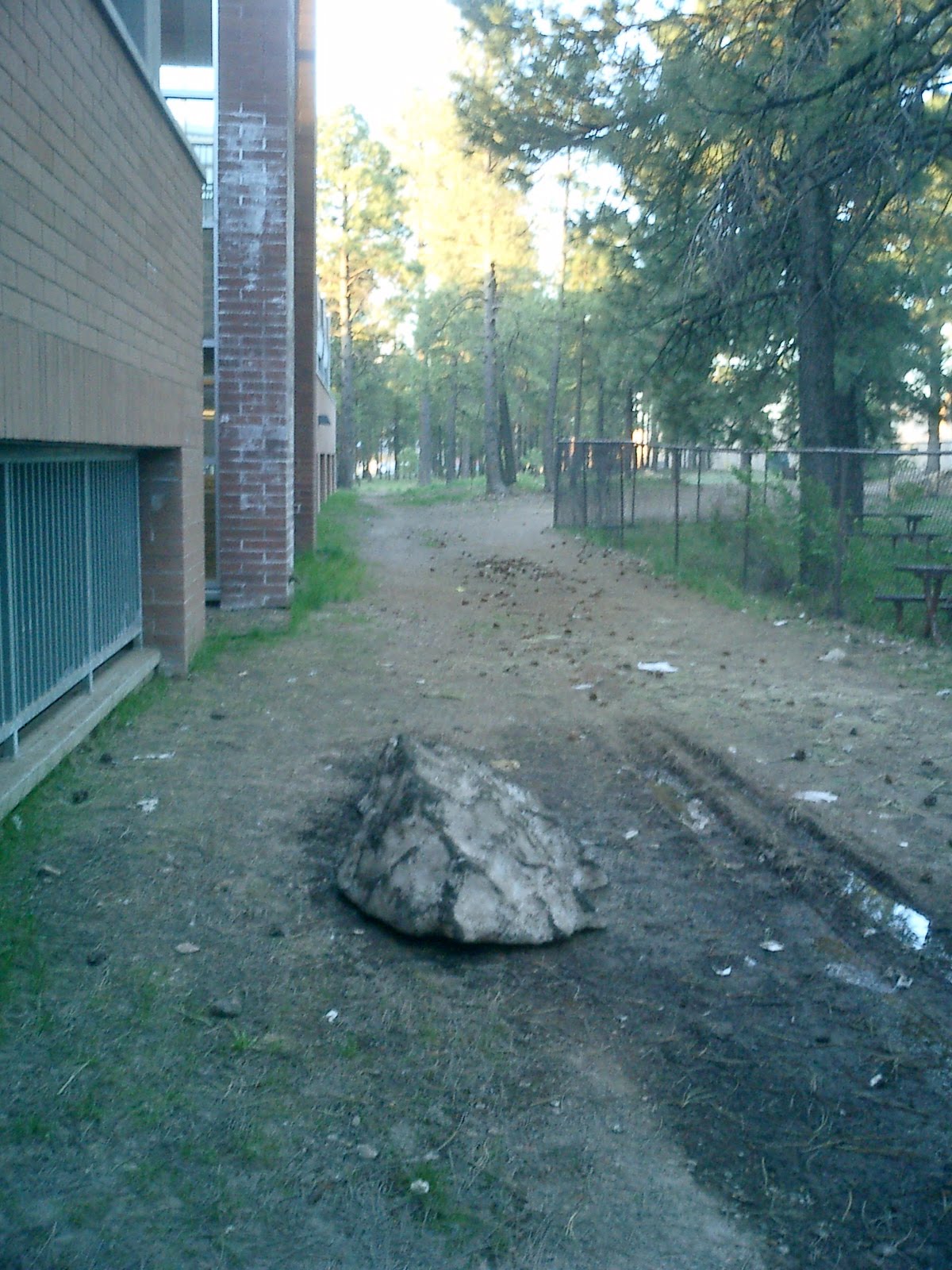
This dirty lump is the sorry remnants of the 64" of snow we had four months ago. Over five days in January we got dumped on with more than five feet of snow and some of it is still here! What a winter! This picture was taken on 17 May on my way to work.

Sunday, April 11, 2010

Finally, the back porch

...
Warm weather has arrived at this community sitting at 7000 feet. I enjoyed its advent with a few tunes on the iPod out on my back porch on Friday ...

Sunday, January 24, 2010

Snowed in

.
A day has passed since the storm blew out. I took a little walk Sunday at sunrise. I was actually surprised that some parts of a few roads and sidewalks were down to bare concrete or asphalt. Still, a lot remains buried.

The view from my front porch on the second story looking north ...
... and looking south ...

There
is a sidewalk that goes between these buildings, but whoever was shoveling apparently gave up. The snow is about the level of my neck through there ...

My humble abode on the second floor, with the front porch on the left, the living room window (with the organ pipes) and the balcony in front of a bedroom. Note the venting stack barely visible on the roof ...


My house is at the end of the building on the right, with the branch of a snow-laden pine apparently pointing out my second-floor balcony ...


Snowed in. This shot also has the Peaks in the background, the highest point in the state at over 12,000 feet. The ski area called Snowbowl, at 11,000 feet, got well over 10 feet of new snow this week, which translates into heaven for skiers and snowboarders ...

Friday, January 22, 2010

3rd biggest snowfall

Friday evening, 22 January 2010, and we have about 10 more hours predicted of snow and snow showers, heavy at times. Currently we have about 55 inches on the ground from three storms beginning last Monday. We could pick up 5 more inches. The last storm alone dumped more than 40 inches. This week is being reported as the third most snowfall in the history of the city. (The most is 84 inches in 1967.)

Yesterday, with the cancellation of classes, students were loaded with energy and out in the snow throwing snowballs, building snow forts and plunging off 2nd-story balconies into the soft snow below. Today, it truly is a ghost town here, with virtually no one leaving their homes anywhere in the city. Driving is practically non-existent. Even here in the apartment complex, there are very few footprints in the snow. We had all stocked up on food and are simply waiting it out it appears.

Monday, for me, will be a very early day indeed, as I head in to work (about a mile walk) and try to get all our vehicles started up and shoveled out (9 of our 16 vehicles are parked outside). The weather, it appears, will remain cold for the time being, so little melt. This will be another interesting week.

Here are some comparison photos. You can click to enlarge.


Next day

Same picture location as my previous post, just 24 hours later. Total so far this week 45 inches, and the weather service is predicting 10-18 more inches before the storm moves out tomorrow (Saturday).

Thursday, January 21, 2010

Not done by a long shot

These two shots are looking outside my living room window at about 2 pm today (Thursday). And this amount of snow is only the beginning. They're calling for about 2 more feet before it all ends about noon on Saturday. The University was smart and canceled classes today and probably will again tomorrow. I'm staying in where it's cozy and warmmmmmmm.


Storm train round 3

Could be messy ...This being the 3rd snow-maker this week, and the one with the most water, it may prove to be very messy because a tongue of warm air may intrude north and cause the snow to turn to rain for awhile before freezing up again later. Our family has all been through glop like that before and it's not nice.

Interesting that the bulk of the monster is coming from San Diego. Note that at the moment this screenshot was taken, DOD (circled) is not having any rain. On the other hand, I am seeing moderate snow outside my window. I'll be going in to work this morning, wondering if the 6 am report from the school will include any cancellations. School may close (the city public schools have been closed all week), as this storm is supposed to last through Friday night (it is 3 am Thursday as I type).

If nothing else, the picture-possibilities should be nice.

Wednesday, January 20, 2010

Here comes round 3

And it looks to be a doozie!

Tuesday, January 19, 2010

An icycle quilt for you


Pineapple express

DOD, you're cleared ... looks like the train of storms coming through your area and mine (and heading on east) are zooming toward us from the north Pacific islands. So no culpability lol.

The screenshot here shows Flagstaff inside the yellow circle looking into the eyes of a stampeding weather system heading our way (indicated by arrow, which was the direction of the precipitation when I took this screenshot).

This is second in a series of three substantial snow-makers. The first was predicted to lay 12 inches on the ground, but we ended up with 6, although it was a very heavy, moisture-laded content. Not the usual fluff.

Tonight's may mimic the first, perhaps add a few more inches. Then on Wednesday night and Thursday the mama goose is supposed to fly in. We're all hoping for a day or two of class (and work) cancellations! If not, then it surely succeeded in giving all of us here in the high country something to talk about!

Sunday, January 17, 2010

California Express

Welp, guess I know what I'm gonna be doing this week ...
All that green and yellow is heading straight for me. Can I blame this on DOD? lol

These are the predictions --
Monday: Snow begins in the morning (no work though: holiday)
Tuesday: Snow
Wednesday: Snow
Thursday: Snow
Friday: Snow
Saturday: Snow showers

It appears to be three storms coming off the Pacific, each with more intensity and moisture than the one before. The first is expected to dump 12".

It will be all heavy rain around DOD. I hope the area can survive this OK ...

Maybe they'll close school here *fingers crossed* lol

Tuesday, December 8, 2009

Sou'wester

Nancy and Jay had their Nor'easter recently. Yesterday, DOD and I had our Sou'wester.

Up here in the high country, as the next graphic indicates, there were 26 inches measured last night, 20 inches of it in 12 hours. That was accompanied by 50 mph sustained winds, gusting to 70 mph. While I was asleep we lost power, but I don't know for how long because all my clocks re-set automatically. I knew the outage was the case, though, when I heard my computer reboot as I was sleeping. The reboot woke me up, and I realized that there was also lightning. This graphic is from NOAA Tuesday morning--

We knew the storm was coming Monday morning. By noon on Monday, even though it was Finals Week at the University, all classes were canceled. This is unprecedented for Finals Week. The decision to cancel was most likely taken because blizzard warnings were posted. There haven't been blizzard warnings posted here in over a decade. And while 26 inches isn't really much of a newsmaker here -- last year, for instance, we had a 52-inch storm -- it was the combination of heavy snow and high winds that freaked people out here.

The University also canceled classes and exams for Tuesday as well for the reason that the brunt of the storm was to occur early Tuesday morning. The wind and snow tapered off quickly around 4 am, and when I went to the grocery store at 6:30 am, I took the following pictures before very much shoveling had been done. (Click on pictures to enlarge.)

Stepping out onto my front porch

The view toward market, from just under my balcony

The main entrance to my complex

Even the door knocker had a mantle of snow
Because work closed early Monday and all of Tuesday, I was able to enjoy a nice, quiet day-and-a-half in my cozy, warm home. Wednesday, that will be quite a different story as I head back to work to liberate the many vehicles in our fleet buried under snow.

Thursday, October 1, 2009

First hard freeze


I don't think winter is here just yet (temps will moderate of course in the weeks ahead), but we are getting quite a wake-up call for what is certainly coming. This screen capture was taken at 6 am this morning. The walk to work at that time included sweatshirt, scarf and cap.

Sunday, August 2, 2009

Stifling

If ranges of dewpoint (the temperature at which fog appears) can be thought of as,
Under 50 degrees = dry
50-60 = average
60-70 = sticky
and over 70 = WILTING,
then I wonder how Nancy and Jay have been managing the last week there in the East where dewpoints have been well above 70 degrees.

I remember one time waiting in the sun on an above-ground MBTA platform for a train and the dewpoint was a very damp 76 degrees. That was a bit much.

Compare this to Arizona where the temperature is currently about the same as Virginia (80 degrees) but the dewpoint is 32.

I hope you are both staying inside where it is cool!